Jackson County, Minnesota
Jackson County is a county in the U.S. state of Minnesota. As of the 2010 United States Census, the population was 10,266.[1] Its county seat is Jackson.[2]
Jackson County | |
|---|---|
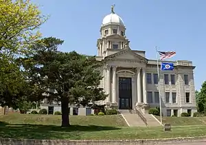 Jackson County Courthouse in Jackson | |
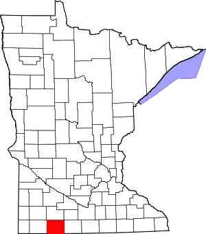 Location within the U.S. state of Minnesota | |
 Minnesota's location within the U.S. | |
| Coordinates: 43°41′N 95°10′W | |
| Country | |
| State | |
| Founded | May 23, 1857 |
| Named for | Henry Jackson |
| Seat | Jackson |
| Largest city | Jackson |
| Area | |
| • Total | 719 sq mi (1,860 km2) |
| • Land | 703 sq mi (1,820 km2) |
| • Water | 16 sq mi (40 km2) 2.3%% |
| Population (2010) | |
| • Total | 10,266 |
| • Estimate (2019) | 9,846 |
| • Density | 14.1/sq mi (5.4/km2) |
| Time zone | UTC−6 (Central) |
| • Summer (DST) | UTC−5 (CDT) |
| Congressional district | 1st |
| Website | www |
History
The county was created on May 23, 1857.[3] It was named for Henry Jackson, the first merchant in St. Paul.[4][5]
Geography
Jackson County lies on the south side of Minnesota. Its south border abuts the north border of the state of Iowa. The Des Moines River flows south-southeasterly through the central part of the county, thence into Iowa. The county terrain is hilly and carved with drainages and gullies. The area is devoted to agriculture.[6] The terrain generally slopes to the south and east; its highest point is on the lower west border, at 1,545' (471m) ASL.[7] The county has a total area of 719 square miles (1,860 km2), of which 703 square miles (1,820 km2) is land and 16 square miles (41 km2) (2.3%) is water.[8]
Lakes[6]
- Andersons Marsh
- Boot Lake
- Chandler Lake
- Clear Lake (part)
- Clear Lake (Des Moines Township and Hunter Township)
- Fish Lake (part)
- Heron Lake (4 lakes, connected by streams, all called Heron Lake)
- Illinois Lake
- Independence Lake
- Iowa Lake (part)
- Lake Flaherty
- Laurs Lake
- Little Spirit Lake
- Loon Lake
- Pearl Lake
- Round Lake
- Rush Lake (Sioux Valley Township)
- Rush Lake (Minneota Township)
- Skunk Lake
- South Heron Lake
- Spirit Lake
- String Lake (part)
- Teal Lake
- Timber Lake
Protected areas[6]
- Anderson County Park
- Bootleg State Wildlife Management Area
- Caraway State Wildlife Management Area
- Des Moines River Scientific and Natural Area
- Holthe Prairie Scientific and Natural Area
- Husen Scientific and Natural Area
- Kilen Woods State Park
- Laurs Lake State Wildlife Management Area
- Minnesota Slough State Wildlife Management Area
- Robertson County Park
- Sangl State Wildlife Management Area
- Summers State Wildlife Management Area
Major highways

Adjacent counties
- Cottonwood County - north
- Watonwan County - northeast
- Martin County - east
- Emmet County, Iowa - southeast
- Dickinson County, Iowa - south
- Osceola County, Iowa - southwest
- Nobles County - west
Demographics
| Historical population | |||
|---|---|---|---|
| Census | Pop. | %± | |
| 1860 | 181 | — | |
| 1870 | 1,825 | 908.3% | |
| 1880 | 4,806 | 163.3% | |
| 1890 | 8,924 | 85.7% | |
| 1900 | 14,793 | 65.8% | |
| 1910 | 14,491 | −2.0% | |
| 1920 | 15,955 | 10.1% | |
| 1930 | 15,863 | −0.6% | |
| 1940 | 16,805 | 5.9% | |
| 1950 | 16,306 | −3.0% | |
| 1960 | 15,501 | −4.9% | |
| 1970 | 14,352 | −7.4% | |
| 1980 | 13,690 | −4.6% | |
| 1990 | 11,677 | −14.7% | |
| 2000 | 11,268 | −3.5% | |
| 2010 | 10,266 | −8.9% | |
| 2019 (est.) | 9,846 | [10] | −4.1% |
| US Decennial Census[11] 1790-1960[12] 1900-1990[13] 1990-2000[14] 2010-2019[1] | |||
2000 census
As of the 2000 United States Census,[15] there were 11,268 people, 4,556 households, and 3,116 families in the county. The population density was 16.0/sqmi (6.19/km2). There were 5,092 housing units at an average density of 7.24/sqmi (2.80/km2). The racial makeup of the county was 97.07% White, 0.09% Black or African American, 0.12% Native American, 1.38% Asian, 0.97% from other races, and 0.38% from two or more races. 1.86% of the population were Hispanic or Latino of any race. 51.9% were of German, 14.1% Norwegian and 5.6% American ancestry.
There were 4,556 households, out of which 29.80% had children under the age of 18 living with them, 60.00% were married couples living together, 5.40% had a female householder with no husband present, and 31.60% were non-families. 28.50% of all households were made up of individuals, and 13.40% had someone living alone who was 65 years of age or older. The average household size was 2.40 and the average family size was 2.95.
The county population contained 24.50% under the age of 18, 7.00% from 18 to 24, 25.30% from 25 to 44, 22.60% from 45 to 64, and 20.50% who were 65 years of age or older. The median age was 41 years. For every 100 females there were 100.60 males. For every 100 females age 18 and over, there were 99.30 males.
The median income for a household in the county was $36,746, and the median income for a family was $43,426. Males had a median income of $29,123 versus $20,860 for females. The per capita income for the county was $17,499. About 5.20% of families and 8.60% of the population were below the poverty line, including 11.00% of those under age 18 and 8.40% of those age 65 or over.
Communities
Census-designated place
Unincorporated communities
Townships
- Alba Township
- Belmont Township
- Christiania Township
- Delafield Township
- Des Moines Township
- Enterprise Township
- Ewington Township
- Heron Lake Township
- Hunter Township
- Kimball Township
- La Crosse Township
- Middletown Township
- Minneota Township
- Petersburg Township
- Rost Township
- Round Lake Township
- Sioux Valley Township
- Weimer Township
- West Heron Lake Township
- Wisconsin Township
Politics
Jackson County voters tended to vote Democratic in times past, but have selected the Republican Party candidate in every national election since 1996 (as of 2016).
| Year | Republican | Democratic | Third parties |
|---|---|---|---|
| 2016 | 65.8% 3,609 | 27.2% 1,492 | 7.0% 383 |
| 2012 | 56.1% 3,044 | 41.8% 2,268 | 2.2% 118 |
| 2008 | 50.8% 2,858 | 46.6% 2,618 | 2.6% 147 |
| 2004 | 52.3% 3,024 | 45.9% 2,652 | 1.8% 103 |
| 2000 | 51.0% 2,773 | 43.5% 2,364 | 5.5% 301 |
| 1996 | 36.9% 2,153 | 46.7% 2,727 | 16.4% 959 |
| 1992 | 29.2% 1,824 | 39.7% 2,481 | 31.1% 1,947 |
| 1988 | 44.1% 2,629 | 55.0% 3,275 | 0.9% 55 |
| 1984 | 47.3% 3,131 | 51.9% 3,437 | 0.8% 55 |
| 1980 | 48.0% 3,391 | 43.4% 3,062 | 8.7% 611 |
| 1976 | 39.4% 2,870 | 59.2% 4,311 | 1.5% 106 |
| 1972 | 51.5% 3,599 | 47.3% 3,304 | 1.2% 86 |
| 1968 | 42.7% 2,886 | 52.0% 3,515 | 5.4% 365 |
| 1964 | 34.8% 2,441 | 65.2% 4,576 | 0.1% 4 |
| 1960 | 47.9% 3,591 | 52.0% 3,898 | 0.2% 13 |
| 1956 | 52.2% 3,543 | 47.6% 3,232 | 0.1% 9 |
| 1952 | 62.1% 4,558 | 37.7% 2,771 | 0.2% 13 |
| 1948 | 32.8% 2,288 | 65.2% 4,541 | 2.0% 140 |
| 1944 | 44.8% 2,789 | 54.9% 3,417 | 0.4% 24 |
| 1940 | 45.3% 3,387 | 54.3% 4,065 | 0.4% 30 |
| 1936 | 23.3% 1,676 | 72.1% 5,187 | 4.6% 332 |
| 1932 | 26.5% 1,524 | 71.7% 4,129 | 1.9% 108 |
| 1928 | 55.1% 3,099 | 44.5% 2,503 | 0.5% 26 |
| 1924 | 49.0% 2,760 | 7.2% 407 | 43.8% 2,470 |
| 1920 | 83.6% 4,313 | 13.9% 715 | 2.5% 130 |
| 1916 | 52.0% 1,503 | 44.0% 1,272 | 4.1% 118 |
| 1912 | 17.1% 468 | 33.4% 913 | 49.4% 1,350 |
| 1908 | 58.9% 1,575 | 37.9% 1,013 | 3.1% 84 |
| 1904 | 76.1% 2,032 | 20.7% 554 | 3.2% 85 |
| 1900 | 61.4% 1,757 | 34.7% 993 | 4.0% 114 |
| 1896 | 56.5% 1,558 | 41.7% 1,150 | 1.8% 49 |
| 1892 | 46.2% 901 | 36.9% 721 | 16.9% 330 |
References
- "State & County QuickFacts". United States Census Bureau. Archived from the original on June 7, 2011. Retrieved September 1, 2013.
- "Find a County". National Association of Counties. Archived from the original on May 31, 2011. Retrieved June 7, 2011.
- "Minnesota Place Names". Minnesota Historical Society. Archived from the original on June 20, 2012. Retrieved March 18, 2014.
- Gannett, Henry (1905). The Origin of Certain Place Names in the United States. Govt. Print. Off. p. 167.
- "Henry Jackson Member Record". Minnesota Legislative Reference Library. Retrieved October 8, 2013.
- Jackson County MN Google Maps (accessed 12 March 2019)
- ""Find an Altitude/Jackson County MN" Google Maps (accessed 12 March 2019)". Archived from the original on May 21, 2019. Retrieved March 13, 2019.
- "2010 Census Gazetteer Files". US Census Bureau. August 22, 2012. Archived from the original on September 21, 2013. Retrieved October 18, 2014.
- Nelson, Steven (2011). Savanna Soils of Minnesota. Minnesota: Self. pp. 65-67. ISBN 978-0-615-50320-2.
- "Population and Housing Unit Estimates". Retrieved March 26, 2020.
- "US Decennial Census". US Census Bureau. Retrieved October 18, 2014.
- "Historical Census Browser". University of Virginia Library. Retrieved October 18, 2014.
- "Population of Counties by Decennial Census: 1900 to 1990". US Census Bureau. Retrieved October 18, 2014.
- "Census 2000 PHC-T-4. Ranking Tables for Counties: 1990 and 2000" (PDF). US Census Bureau. Retrieved October 18, 2014.
- "U.S. Census website". US Census Bureau. Retrieved January 31, 2008.
- Leip, David. "Atlas of US Presidential Elections". uselectionatlas.org. Retrieved September 19, 2018.
External links
Places adjacent to Jackson County, Minnesota | ||||||||||
|---|---|---|---|---|---|---|---|---|---|---|
| ||||||||||
Municipalities and communities of Jackson County, Minnesota, United States | ||
|---|---|---|
| Cities | Map of Minnesota highlighting Jackson County | |
| Townships | ||
| CDP | ||
| Unincorporated communities | ||
| ||

| Authority control |
|---|