Norman County, Minnesota
Norman County is a county in the northwestern part of the U.S. state of Minnesota. As of the 2010 United States Census, the population was 6,852.[2] Its county seat is Ada.[3] The county is in Minnesota's Red River Valley region.
Norman County | |
|---|---|
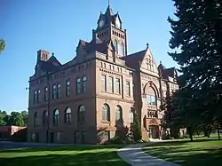 Norman County Courthouse in Ada, Minnesota. | |
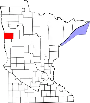 Location within the U.S. state of Minnesota | |
 Minnesota's location within the U.S. | |
| Coordinates: 47°20′N 96°28′W | |
| Country | |
| State | |
| Founded | February 17, 1881[1] |
| Named for | Norwegian settlers |
| Seat | Ada |
| Largest city | Ada |
| Area | |
| • Total | 877 sq mi (2,270 km2) |
| • Land | 873 sq mi (2,260 km2) |
| • Water | 3.9 sq mi (10 km2) 0.4%% |
| Population (2010) | |
| • Total | 6,852 |
| • Estimate (2019) | 6,375 |
| • Density | 7.56/sq mi (2.92/km2) |
| Time zone | UTC−6 (Central) |
| • Summer (DST) | UTC−5 (CDT) |
| Congressional district | 7th |
| Website | www |
History
The county was created by the Minnesota legislature on 17 March 1881, with Ada (which had been founded in 1874) as county seat. It was named in recognition of the many settlers who came from Scandinavian countries, especially Norway.[4] Another source posits that it was named for Norman Kittson, an early historical figure of the region.[5]
Geography
Norman County lies on Minnesota's western border, abutting North Dakota across the Red River, which flows north along (and defines) the county's west line. The Wild Rice River flows west through the lower part of the county, discharging into the Red slightly north of the county's southwest corner. The Marsh River rises in central Norman County and flows northwest into the Red near the county's northwest corner. The county terrain consists of low rolling hills, carved by drainages and lightly dotted with lakes and swampy areas. The terrain is devoted to agriculture.[6] The terrain slopes to the north and west with its highest point near its southeast corner, at 1,224' (373m) ASL.[7] The county has an area of 877 square miles (2,270 km2), of which 873 square miles (2,260 km2) is land and 3.9 square miles (10 km2) (0.4%) water.[8] Flom Township contains a prominent, irregular hill of morainic drift known as Frenchman's Bluff. It rises 150' (46m) above the shoreline of the former Lake Agassis, three miles (5 km) to the northwest.[4]
Major highways
Adjacent counties
- Polk County - north
- Mahnomen County - east
- Becker County - southeast
- Clay County - south
- Cass County, North Dakota - southwest
- Traill County, North Dakota - west
Protected areas[6]
- Agassiz Dunes Scientific and Natural Area (part)
- Agassiz No. 1 State Wildlife Management Area
- Agassiz No. 2 State Wildlife Management Area
- Dalby State Wildlife Management Area
- Faith State Wildlife Management Area
- Home Lake State Wildlife Management Area
- Moccasin State Wildlife Management Area
- Neal State Wildlife Management Area
- Prairie Smoke Dunes Scientific and Natural Area
- Sandpiper Scientific and Natural Area
- Santee Prairie Scientific and Natural Area
- Syre State Wildlife Management Area
- Twin Valley Prairie Scientific and Natural Area
- Twin Valley State Wildlife Management Area
- Vangsness State Wildlife Management Area
Lakes[6]
- Home Lake
- Lockhart Swamp
Demographics
| Historical population | |||
|---|---|---|---|
| Census | Pop. | %± | |
| 1890 | 10,618 | — | |
| 1900 | 15,045 | 41.7% | |
| 1910 | 13,446 | −10.6% | |
| 1920 | 14,880 | 10.7% | |
| 1930 | 14,061 | −5.5% | |
| 1940 | 14,746 | 4.9% | |
| 1950 | 12,909 | −12.5% | |
| 1960 | 11,253 | −12.8% | |
| 1970 | 10,008 | −11.1% | |
| 1980 | 9,379 | −6.3% | |
| 1990 | 7,975 | −15.0% | |
| 2000 | 7,442 | −6.7% | |
| 2010 | 6,852 | −7.9% | |
| 2019 (est.) | 6,375 | [10] | −7.0% |
| US Decennial Census[11] 1790-1960[12] 1900-1990[13] 1990-2000[14] 2010-2019[2] | |||
2000 census
As of the 2000 United States Census, there were 7,442 people, 3,010 households, and 2,007 families in the county. The population density was 8.52/sqmi (3.29/km2). There were 3,455 housing units at an average density of 3.96/sqmi (1.53/km2). The racial makeup of the county was 95.30% White, 0.11% Black or African American, 1.73% Native American, 0.31% Asian, 1.13% from other races, and 1.42% from two or more races. 3.05% of the population were Hispanic or Latino of any race. 57.5% were of Norwegian and 21.7% German ancestry.
There were 3,010 households, out of which 30.10% had children under the age of 18 living with them, 57.80% were married couples living together, 5.90% had a female householder with no husband present, and 33.30% were non-families. 31.30% of all households were made up of individuals, and 17.00% had someone living alone who was 65 years of age or older. The average household size was 2.41 and the average family size was 3.04.
The county population contained 25.70% under the age of 18, 6.20% from 18 to 24, 24.10% from 25 to 44, 23.00% from 45 to 64, and 20.90% of over age 64. The median age was 41 years. For every 100 females there were 98.60 males. For every 100 females age 18 and over, there were 96.80 males.
The median income for a household in the county was $32,535, and the median income for a family was $41,280. Males had a median income of $28,674 versus $20,619 for females. The per capita income for the county was $15,895. About 7.10% of families and 10.30% of the population were below the poverty line, including 10.70% of those under age 18 and 14.30% of those age 65 or over.
Communities
Townships
- Anthony Township
- Bear Park Township
- Flom Township
- Fossum Township
- Good Hope Township
- Green Meadow Township
- Halstad Township
- Hegne Township
- Hendrum Township
- Home Lake Township
- Lake Ida Township
- Lee Township
- Lockhart Township
- Mary Township
- McDonaldsville Township
- Pleasant View Township
- Rockwell Township
- Shelly Township
- Spring Creek Township
- Strand Township
- Sundal Township
- Waukon Township
- Wild Rice Township
- Winchester Township
Government and politics
Norman County has often voted Democratic. Between 1968 and 2016, the county selected the Democratic candidate in nine of the 12 presidential elections.
| Year | Republican | Democratic | Third parties |
|---|---|---|---|
| 2020 | 56.8% 1,953 | 40.8% 1,404 | 2.4% 84 |
| 2016 | 52.1% 1,699 | 38.8% 1,264 | 9.1% 298 |
| 2012 | 43.2% 1,384 | 53.9% 1,730 | 2.9% 93 |
| 2008 | 35.1% 1,204 | 62.0% 2,129 | 2.9% 101 |
| 2004 | 47.1% 1,794 | 51.3% 1,954 | 1.6% 62 |
| 2000 | 49.7% 1,808 | 43.3% 1,575 | 7.1% 258 |
| 1996 | 37.4% 1,392 | 50.4% 1,875 | 12.2% 455 |
| 1992 | 37.4% 1,541 | 43.3% 1,784 | 19.3% 796 |
| 1988 | 45.2% 1,789 | 54.3% 2,149 | 0.5% 18 |
| 1984 | 49.2% 2,152 | 50.3% 2,202 | 0.5% 23 |
| 1980 | 44.9% 2,192 | 46.2% 2,253 | 8.9% 435 |
| 1976 | 39.6% 1,983 | 58.8% 2,946 | 1.7% 83 |
| 1972 | 50.5% 2,536 | 48.7% 2,444 | 0.8% 41 |
| 1968 | 39.5% 1,981 | 56.4% 2,828 | 4.1% 203 |
| 1964 | 31.4% 1,662 | 68.5% 3,631 | 0.2% 8 |
| 1960 | 47.3% 2,642 | 52.5% 2,932 | 0.2% 12 |
| 1956 | 46.0% 2,338 | 53.9% 2,740 | 0.1% 3 |
| 1952 | 55.1% 3,069 | 44.2% 2,465 | 0.7% 39 |
| 1948 | 32.9% 1,695 | 62.9% 3,245 | 4.2% 217 |
| 1944 | 39.5% 1,884 | 59.7% 2,846 | 0.8% 38 |
| 1940 | 36.5% 2,161 | 62.8% 3,716 | 0.7% 39 |
| 1936 | 28.5% 1,570 | 68.7% 3,778 | 2.8% 154 |
| 1932 | 25.1% 1,313 | 68.8% 3,601 | 6.1% 320 |
| 1928 | 67.4% 3,308 | 28.5% 1,401 | 4.1% 200 |
| 1924 | 45.8% 1,997 | 3.9% 171 | 50.3% 2,195 |
| 1920 | 74.2% 3,451 | 10.3% 481 | 15.5% 721 |
| 1916 | 42.1% 1,046 | 43.3% 1,076 | 14.6% 362 |
| 1912 | 14.7% 329 | 22.9% 510 | 62.4% 1,393 |
| 1908 | 55.3% 1,276 | 28.6% 661 | 16.1% 372 |
| 1904 | 78.0% 1,782 | 7.1% 161 | 14.9% 341 |
| 1900 | 53.6% 1,492 | 34.6% 964 | 11.8% 329 |
| 1896 | 49.6% 1,382 | 46.8% 1,304 | 3.6% 100 |
| 1892 | 39.0% 724 | 15.8% 294 | 45.2% 840 |
| Position | Name | District | |
|---|---|---|---|
| Commissioner | Marvin Gunderson | District 1 | |
| Commissioner | Nathan Redland | District 2 | |
| Commissioner | Steve Jacobson | District 3 | |
| Commissioner and Chairperson | Lee Ann Hall | District 4 | |
| Commissioner | Steve Bommersbach | District 5 | |
| Position | Name | Affiliation | District | |
|---|---|---|---|---|
| Senate | Kent Eken[17] | Democrat | District 4 | |
| House of Representatives | Paul Marquart[18] | Democrat | District 4B | |
| Position | Name | Affiliation | District | |
|---|---|---|---|---|
| House of Representatives | Collin Peterson[19] | Democrat | 7th | |
| Senate | Amy Klobuchar[20] | Democrat | N/A | |
| Senate | Tina Smith[21] | Democrat | N/A | |
References
- "Minnesota Place Names". Minnesota Historical Society. Archived from the original on June 20, 2012. Retrieved March 18, 2014.
- "State & County QuickFacts". United States Census Bureau. Archived from the original on June 7, 2011. Retrieved September 1, 2013.
- "Find a County". National Association of Counties. Retrieved June 7, 2011.
- Upham, Warren (1920). Minnesota Geographic Names: Their Origin and Historic Significance. Minnesota Historical Society. pp. 381–384.
- Gannett, Henry (1905). The Origin of Certain Place Names in the United States. Government Printing Office. p. 177.
Norman County named after Norman Kittson.
- Norman County MN Google Maps (accessed April 17, 2019)
- ""Find an Altitude/Norman County MN" Google Maps (accessed April 17, 2019)". Archived from the original on 21 May 2019. Retrieved April 17, 2019.
- "2010 Census Gazetteer Files". US Census Bureau. August 22, 2012. Archived from the original on September 21, 2013. Retrieved October 24, 2014.
- Nelson, Steven (2011). Savanna Soils of Minnesota. Minnesota: Self. pp. 57-60. ISBN 978-0-615-50320-2.
- "Population and Housing Unit Estimates". Retrieved March 26, 2020.
- "US Decennial Census". US Census Bureau. Retrieved October 24, 2014.
- "Historical Census Browser". University of Virginia Library. Retrieved October 24, 2014.
- "Population of Counties by Decennial Census: 1900 to 1990". US Census Bureau. Retrieved October 24, 2014.
- "Census 2000 PHC-T-4. Ranking Tables for Counties: 1990 and 2000" (PDF). US Census Bureau. Retrieved October 24, 2014.
- Leip, David. "Atlas of US Presidential Elections". uselectionatlas.org. Retrieved October 10, 2018.
- "Norman County". www.co.norman.mn.us. Retrieved 2020-06-25.
- "MN State Senate". www.senate.mn. Retrieved 2020-06-25.
- "Rep. Paul Marquart (04B) - Minnesota House of Representatives". www.house.leg.state.mn.us. Retrieved 2020-06-25.
- "Congressman Collin Peterson". Congressman Collin Peterson. Retrieved 2020-06-25.
- "U.S. Senator Amy Klobuchar". www.klobuchar.senate.gov. Retrieved 2020-06-24.
- "Home". Senator Tina Smith. Retrieved 2020-06-24.
External links
Places adjacent to Norman County, Minnesota | ||||||||||
|---|---|---|---|---|---|---|---|---|---|---|
| ||||||||||
Municipalities and communities of Norman County, Minnesota, United States | ||
|---|---|---|
| Cities | Map of Minnesota highlighting Norman County | |
| Townships | ||
| Unincorporated communities | ||
| Ghost town | ||
| ||

| Authority control |
|---|