Cottonwood County, Minnesota
Cottonwood County is a county in the U.S. state of Minnesota. As of the 2010 United States Census, the population was 11,687.[1] Its county seat is Windom.[2]
Cottonwood County | |
|---|---|
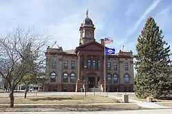 Cottonwood County Courthouse | |
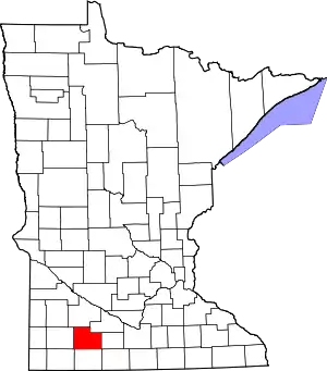 Location within the U.S. state of Minnesota | |
 Minnesota's location within the U.S. | |
| Coordinates: 44°01′N 95°11′W | |
| Country | |
| State | |
| Founded | May 23, 1857 (created) July 29, 1870 (organized) |
| Named for | Cottonwood River |
| Seat | Windom |
| Largest city | Windom |
| Area | |
| • Total | 649 sq mi (1,680 km2) |
| • Land | 639 sq mi (1,660 km2) |
| • Water | 10 sq mi (30 km2) 1.5%% |
| Population (2010) | |
| • Total | 11,687 |
| • Estimate (2019) | 11,196 |
| • Density | 17.7/sq mi (6.8/km2) |
| Time zone | UTC−6 (Central) |
| • Summer (DST) | UTC−5 (CDT) |
| Congressional districts | 1st, 7th |
| Website | www |
History
The county was created on May 23, 1857, named for the river in Germantown Township ("cottonwood" is the English meaning of the Dakota Sioux word "Waraju").[3][4] Minnesota Governor Horace Austin appointed three county commissioners when the county was established. They met at a home about six miles northwest of Windom on the Des Moines River at Big Bend. During this meeting, they designated the commissioners' districts and changed various county officers. The county organization was completed on July 29, 1870. The first general election was held in the county that November. The first deed of record was filed on January 10, 1870. The first land assessments were made in 1871, and the first taxes were paid in 1872.[5]
County NRHP listings
- The Cottonwood County Courthouse (1904), an example of Neoclassical architecture, is listed in the National Register of Historic Places.[6]
- Mountain Park, southeast of Mountain Lake, has been listed on the National Register of Historic Places since 1973.[7] A 1976 archeological dig unearthed evidence of a Fox Indian habitation there circa 500 B.C., the oldest human habitation to be discovered in Minnesota.[8]
- The Jeffers Petroglyphs, near Jeffers, contain pre-European Native American rock carvings. Listed in the National Register of Historic Places.[7]
Geography
The Heron Lake Outflow flows east through the lower part of Cottonwood County. The county terrain consists of low rolling hills, devoted to agriculture.[10] The terrain generally slopes to the east, with the northern portion also sloping north and the lower portion sloping south. The highest point is on the midpoint of the west border, at 1,535' (468m) ASL.[11] The county has an area of 649 square miles (1,680 km2), of which 639 square miles (1,660 km2) is land and 10 square miles (26 km2) (1.5%) is water.[12]
Watersheds
The northeastern part of the county drains north to the Minnesota River through numerous small creeks, the Cottonwood River and Watonwan River. The southwestern part drains south through the Des Moines River. These two watersheds come together at the Mississippi River near Keokuk, Iowa. Most wetlands in the county have been drained for agricultural use.
Lakes
| Des Moines River Watershed | Minnesota River Watershed |
|---|---|
|
|
Major highways
Adjacent counties
- Redwood County - north
- Brown County - northeast
- Watonwan County - east
- Jackson County - south
- Nobles County - southwest
- Murray County -west
Protected areas[10]
- Delft State Wildlife Management Area
- Dynamite Park
- Lady Bird County Park
- Little Swan Lake State Wildlife Management Area
- Mound Creek County Park
- Mountain County Park
- Pats Grove County Park
- Regehr State Wildlife Management Area
- Red Rock Falls County Park
- Rock Ridge Prairie Scientific and Natural Area
- South Dutch Charlie County Park[13]
- Talcot County Park
Demographics
| Historical population | |||
|---|---|---|---|
| Census | Pop. | %± | |
| 1860 | 12 | — | |
| 1870 | 534 | 4,350.0% | |
| 1880 | 5,533 | 936.1% | |
| 1890 | 7,412 | 34.0% | |
| 1900 | 12,069 | 62.8% | |
| 1910 | 12,651 | 4.8% | |
| 1920 | 14,570 | 15.2% | |
| 1930 | 14,782 | 1.5% | |
| 1940 | 16,143 | 9.2% | |
| 1950 | 15,763 | −2.4% | |
| 1960 | 16,166 | 2.6% | |
| 1970 | 14,887 | −7.9% | |
| 1980 | 14,854 | −0.2% | |
| 1990 | 12,694 | −14.5% | |
| 2000 | 12,167 | −4.2% | |
| 2010 | 11,687 | −3.9% | |
| 2019 (est.) | 11,196 | [14] | −4.2% |
| US Decennial Census[15] 1790-1960[16] 1900-1990[17] 1990-2000[18] 2010-2019[1] | |||

As of the 2000 United States Census,[19] there were 12,167 people, 4,917 households, and 3,338 families in the county. The population density was 19.0/sqmi (7.35/km2). There were 5,376 housing units at an average density of 8.41/sqmi (3.25/km2). The racial makeup of the county was 95.23% White, 0.34% Black or African American, 0.23% Native American, 1.63% Asian, 0.08% Pacific Islander, 1.35% from other races, and 1.14% from two or more races. 2.19% of the population were Hispanic or Latino of any race. 50.2% were of German and 18.6% Norwegian ancestry.
There were 4,917 households, out of which 28.60% had children under the age of 18 living with them, 58.10% were married couples living together, 6.90% had a female householder with no husband present, and 32.10% were non-families. 28.90% of all households were made up of individuals, and 15.90% had someone living alone who was 65 years of age or older. The average household size was 2.39 and the average family size was 2.94.
The county population contained 25.00% under the age of 18, 6.50% from 18 to 24, 23.20% from 25 to 44, 23.20% from 45 to 64, and 22.10% who were 65 years of age or older. The median age was 42 years. For every 100 females there were 94.50 males. For every 100 females age 18 and over, there were 91.50 males.
The median income for a household in the county was $31,943, and the median income for a family was $40,237. Males had a median income of $28,993 versus $19,934 for females. The per capita income for the county was $16,647. About 7.40% of families and 11.70% of the population were below the poverty line, including 18.40% of those under age 18 and 8.70% of those age 65 or over.
Government and politics
Cottonwood County reliably votes Republican. In only one presidential election since 1964 has it selected the Democratic candidate.
| Year | Republican | Democratic | Third parties |
|---|---|---|---|
| 2016 | 64.3% 3,679 | 29.3% 1,678 | 6.4% 364 |
| 2012 | 56.6% 3,316 | 41.5% 2,433 | 1.9% 113 |
| 2008 | 52.3% 3,157 | 45.7% 2,759 | 2.0% 120 |
| 2004 | 55.9% 3,557 | 42.8% 2,726 | 1.4% 86 |
| 2000 | 54.5% 3,369 | 40.5% 2,503 | 5.0% 309 |
| 1996 | 42.7% 2,633 | 44.4% 2,737 | 13.0% 802 |
| 1992 | 37.3% 2,481 | 35.8% 2,382 | 26.9% 1,788 |
| 1988 | 51.8% 3,390 | 47.3% 3,095 | 0.9% 60 |
| 1984 | 57.9% 4,275 | 41.6% 3,073 | 0.5% 37 |
| 1980 | 54.3% 4,258 | 37.7% 2,958 | 8.0% 631 |
| 1976 | 49.7% 3,906 | 48.5% 3,813 | 1.8% 140 |
| 1972 | 60.2% 4,396 | 38.4% 2,802 | 1.4% 105 |
| 1968 | 54.8% 4,050 | 41.2% 3,046 | 4.0% 295 |
| 1964 | 45.5% 3,423 | 54.3% 4,090 | 0.2% 15 |
| 1960 | 64.6% 5,087 | 35.2% 2,768 | 0.2% 17 |
| 1956 | 66.3% 4,619 | 33.6% 2,344 | 0.1% 5 |
| 1952 | 71.5% 5,488 | 27.8% 2,130 | 0.7% 56 |
| 1948 | 48.6% 3,222 | 50.3% 3,333 | 1.2% 77 |
| 1944 | 62.1% 3,916 | 37.3% 2,354 | 0.6% 38 |
| 1940 | 58.3% 4,228 | 41.2% 2,991 | 0.5% 36 |
| 1936 | 37.9% 2,509 | 59.3% 3,929 | 2.8% 185 |
| 1932 | 39.4% 1,921 | 59.0% 2,877 | 1.6% 78 |
| 1928 | 67.5% 3,405 | 31.8% 1,604 | 0.8% 39 |
| 1924 | 57.0% 2,722 | 4.5% 217 | 38.5% 1,837 |
| 1920 | 86.3% 3,882 | 10.0% 451 | 3.7% 167 |
| 1916 | 60.2% 1,425 | 32.2% 762 | 7.6% 179 |
| 1912 | 16.1% 325 | 25.3% 511 | 58.6% 1,181 |
| 1908 | 65.8% 1,240 | 27.9% 526 | 6.3% 118 |
| 1904 | 84.4% 1,536 | 11.7% 213 | 3.9% 70 |
| 1900 | 68.5% 1,368 | 27.4% 547 | 4.1% 82 |
| 1896 | 58.7% 1,242 | 38.3% 810 | 3.0% 63 |
| 1892 | 52.4% 727 | 14.6% 202 | 33.1% 459 |
| Position | Name | District | |
|---|---|---|---|
| Commissioner | Larry Anderson | District 1 | |
| Commissioner and Chairperson | Kevin Stevens | District 2 | |
| Commissioner | Donna Gravley | District 3 | |
| Commissioner | Norman Holven | District 4 | |
| Commissioner | Tom Appel | District 5 | |
| Position | Name | Affiliation | District | |
|---|---|---|---|---|
| Senate | Bill Weber[22] | Republican | District 22 | |
| House of Representatives | Rod Hamilton[23] | Republican | District 22B | |
| Position | Name | Affiliation | District | |
|---|---|---|---|---|
| House of Representatives | Jim Hagedorn[24] | Republican | 1st | |
| House of Representatives | Collin Peterson[25] | Democrat | 7th | |
| Senate | Amy Klobuchar[26] | Democrat | N/A | |
| Senate | Tina Smith[27] | Democrat | N/A | |
Communities
Cities
- Bingham Lake
- Comfrey (partial)
- Jeffers
- Mountain Lake
- Storden
- Westbrook
- Windom (county seat)
Unincorporated community
Townships
- Amboy Township
- Amo Township
- Ann Township
- Carson Township
- Dale Township
- Delton Township
- Germantown Township
- Great Bend Township
- Highwater Township
- Lakeside Township
- Midway Township
- Mountain Lake Township
- Rose Hill Township
- Selma Township
- Southbrook Township
- Springfield Township
- Storden Township
- Westbrook Township
Footnotes
- "State & County QuickFacts". United States Census Bureau. Archived from the original on July 9, 2011. Retrieved August 31, 2013.
- "Find a County". National Association of Counties. Archived from the original on May 31, 2011. Retrieved June 7, 2011.
- Upham, Warren (1920). Minnesota Geographic Names: Their Origin and Historic Significance. Minnesota Historical Society. p. 149.
- Gannett, Henry (1905). The Origin of Certain Place Names in the United States. Govt. Print. Off. p. 93.
- "About Cottonwood County". www.co.cottonwood.mn.us. Retrieved April 17, 2018.
- Nelson, Charles W.; Susan Zeik (October 26, 1976). "National Register of Historic Places Inventory -- Nomination Form: Cottonwood County Courthouse". National Park Service. Retrieved June 8, 2016. Cite journal requires
|journal=(help) - "National Register of Historic Places". NRHP. Retrieved October 15, 2015.
- "Cottonwood County Parks". Cottonwood County MN. Retrieved October 15, 2015.
- Nelson, Steven (2011). Savanna Soils of Minnesota. Minnesota: Self. pp. 69-70. ISBN 978-0-615-50320-2.
- Cottonwood County MN Google Maps (accessed 7 March 2019)
- ""Find an Altitude/Cottonwood County MN" Google Maps (accessed 7 March 2019)". Archived from the original on May 21, 2019. Retrieved March 7, 2019.
- "2010 Census Gazetteer Files". US Census Bureau. August 22, 2012. Archived from the original on October 6, 2014. Retrieved October 6, 2014.
- The park is named after the county's first resident of European descent, Charles "Dutch Charlie" Zierke. "Cottonwood County Timeline". Cottonwood County Historical Society. Retrieved August 16, 2009.
- "Population and Housing Unit Estimates". Retrieved March 26, 2020.
- "US Decennial Census". US Census Bureau. Retrieved October 6, 2014.
- "Historical Census Browser". University of Virginia Library. Retrieved October 6, 2014.
- "Population of Counties by Decennial Census: 1900 to 1990". US Census Bureau. Retrieved October 6, 2014.
- "Census 2000 PHC-T-4. Ranking Tables for Counties: 1990 and 2000" (PDF). US Census Bureau. Retrieved October 6, 2014.
- "U.S. Census website". US Census Bureau. Retrieved January 31, 2008.
- Leip, David. "Atlas of US Presidential Elections". uselectionatlas.org. Retrieved April 17, 2018.
- "Cottonwood County :: County Commissioners". www.co.cottonwood.mn.us. Retrieved June 25, 2020.
- "MN State Senate". www.senate.mn. Retrieved June 25, 2020.
- "Rep. Rod Hamilton (22B) - Minnesota House of Representatives". www.house.leg.state.mn.us. Retrieved June 25, 2020.
- "Representative Jim Hagedorn". Representative Jim Hagedorn. Retrieved June 25, 2020.
- "Congressman Collin Peterson". Congressman Collin Peterson. Retrieved June 24, 2020.
- "U.S. Senator Amy Klobuchar". www.klobuchar.senate.gov. Retrieved June 24, 2020.
- "Home". Senator Tina Smith. Retrieved June 24, 2020.
Further reading
- John A. Brown (ed.), History of Cottonwood and Watonwan counties, Minnesota: Their People, Industries, and Institutions: With Biographical Sketches of Representative Citizens and Genealogical Records of Many of the Old Families. In Two Volumes. Indianapolis, IN: B.F. Bowen and Company, 1916. Volume 1|Volume 2
- Cottonwood County Minnesota Highway Map, Cottonwood County Highway Department, 2003.
- DeLorme's Minnesota Atlas and Gazetteer.
External links
| Wikisource has the text of the 1879 American Cyclopædia article Cottonwood. |
Places adjacent to Cottonwood County, Minnesota | ||||||||||
|---|---|---|---|---|---|---|---|---|---|---|
| ||||||||||
Municipalities and communities of Cottonwood County, Minnesota, United States | ||
|---|---|---|
| Cities | Map of Minnesota highlighting Cottonwood County | |
| Townships | ||
| Unincorporated community | ||
| Ghost town | ||
| Footnotes | ‡This populated place also has portions in an adjacent county or counties | |
| ||

| Authority control |
|---|