Otsego, Minnesota
Otsego is a city in Wright County, Minnesota, United States. The population was 13,571 at the 2010 census.[6] Minnesota State Highway 101 serves as one of the main routes in the city. As of 2019 population estimates, Otsego is the second-largest city in Wright County, and the 64th largest in Minnesota.[7]
Otsego | |
|---|---|
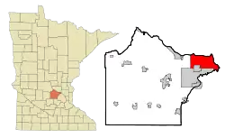 Location of the city of Otsego within Wright County, Minnesota | |
| Coordinates: 45°16′18″N 93°35′56″W | |
| Country | United States |
| State | Minnesota |
| County | Wright |
| Government | |
| • Mayor | Jessica Stockamp |
| Area | |
| • Total | 30.53 sq mi (79.1 km2) |
| • Land | 29.61 sq mi (76.69 km2) |
| • Water | 0.92 sq mi (2.39 km2) |
| Elevation | 879 ft (268 m) |
| Population (11530 United States Census)[2] | |
| • Total | 13,571 |
| • Estimate (2019)[3] | 18,113 |
| • Density | 611.74/sq mi (236.19/km2) |
| Time zone | UTC-6 (Central (CST)) |
| • Summer (DST) | UTC-5 (CDT) |
| ZIP codes | 55301, 55362, 55330 |
| Area code(s) | 763 |
| FIPS code | 27-49138[4] |
| GNIS feature ID | 0649039[5] |
| Website | City of Otsego |
History
Otsego first became an organized township in 1858, and was named after Otsego County, New York.[8] The township incorporated as the city of Otsego in 1990.[9]
They also filmed a part of "Young Adult" here.[10]
Geography
According to the United States Census Bureau, the city has a total area of 30.49 square miles (78.97 km2); 29.56 square miles (76.56 km2) is land and 0.93 square miles (2.41 km2) is water.[11] Otsego is located at the confluence of the Mississippi and Crow Rivers.
Nearby places include Albertville, St. Michael, Rogers, Elk River, Dayton, and Monticello.
Demographics
| Historical population | |||
|---|---|---|---|
| Census | Pop. | %± | |
| 1880 | 62 | — | |
| 2000 | 6,389 | — | |
| 2010 | 13,571 | 112.4% | |
| 2019 (est.) | 18,113 | [3] | 33.5% |
| U.S. Decennial Census[12] | |||
2010 census
As of the census[2] of 2010, there were 13,571 people, 4,736 households, and 3,560 families living in the city. The population density was 459.1 inhabitants per square mile (177.3/km2). There were 5,022 housing units at an average density of 169.9 per square mile (65.6/km2). The racial makeup of the city was 93.2% White, 1.8% African American, 0.4% Native American, 1.8% Asian, 0.1% Pacific Islander, 0.8% from other races, and 1.9% from two or more races. Hispanic or Latino of any race were 2.4% of the population.
There were 4,736 households, of which 44.5% had children under the age of 18 living with them, 62.9% were married couples living together, 7.4% had a female householder with no husband present, 4.9% had a male householder with no wife present, and 24.8% were non-families. 17.9% of all households were made up of individuals, and 2.8% had someone living alone who was 65 years of age or older. The average household size was 2.86 and the average family size was 3.29.
The median age in the city was 31.8 years. 30.9% of residents were under the age of 18; 6.7% were between the ages of 18 and 24; 35.3% were from 25 to 44; 21.5% were from 45 to 64; and 5.7% were 65 years of age or older. The gender makeup of the city was 50.7% male and 49.3% female.
2000 census
As of the census[4] of 2000, there were 6,389 people, 2,062 households, and 1,674 families living in the city. The population density was 217.5 people per square mile (84.0/km2). There were 2,120 housing units at an average density of 72.2 per square mile (27.9/km2). The racial makeup of the city was 97.26% White, 0.25% African American, 0.36% Native American, 0.72% Asian, 0.56% from other races, and 0.85% from two or more races. Hispanic or Latino of any race were 1.27% of the population. 41.0% were of German, 16.1% Norwegian, 7.0% Swedish, 6.9% Irish and 6.1% American ancestry according to Census 2000.
There were 2,062 households, out of which 46.9% had children under the age of 18 living with them, 71.0% were married couples living together, 5.4% had a female householder with no husband present, and 18.8% were non-families. 12.7% of all households were made up of individuals, and 2.6% had someone living alone who was 65 years of age or older. The average household size was 3.10 and the average family size was 3.41.
In the city, the population was spread out, with 32.5% under the age of 18, 7.7% from 18 to 24, 34.2% from 25 to 44, 21.4% from 45 to 64, and 4.2% who were 65 years of age or older. The median age was 32 years. For every 100 females, there were 108.8 males. For every 100 females age 18 and over, there were 109.1 males.
The median income for a household in the city was $57,422, and the median income for a family was $59,319. Males had a median income of $39,568 versus $28,273 for females. The per capita income for the city was $20,209. About 3.1% of families and 3.2% of the population were below the poverty line, including 2.4% of those under age 18 and 13.8% of those age 65 or over.
Education
A portion of the city is in the St. Michael-Albertville Schools district.[13]
References
- "2019 U.S. Gazetteer Files". United States Census Bureau. Retrieved July 26, 2020.
- "U.S. Census website". United States Census Bureau. Retrieved 2012-11-13.
- "Population and Housing Unit Estimates". United States Census Bureau. May 24, 2020. Retrieved May 27, 2020.
- "U.S. Census website". United States Census Bureau. Retrieved 2008-01-31.
- "US Board on Geographic Names". United States Geological Survey. 2007-10-25. Retrieved 2008-01-31.
- "2010 Census Redistricting Data (Public Law 94-171) Summary File". American FactFinder. U.S. Census Bureau, 2010 Census. Retrieved 23 April 2011.
- Bureau, US Census. "City and Town Population Totals: 2010-2019". The United States Census Bureau.
- Upham, Warren (1920). Minnesota Geographic Names: Their Origin and Historic Significance. Minnesota Historical Society. p. 589.
- "COKLEY v. CITY OF OTSEGO". FindLaw. Retrieved 16 August 2015.
- Young Adult (film)
- "US Gazetteer files 2010". United States Census Bureau. Archived from the original on 2012-01-25. Retrieved 2012-11-13.
- United States Census Bureau. "Census of Population and Housing". Retrieved November 21, 2014.
- "About District 885". St. Michael-Albertville Schools. Retrieved 2020-05-28.
Visit Us 11343 50th St. NE Albertville, MN 55301
External links
Municipalities and communities of Wright County, Minnesota, United States | ||
|---|---|---|
| Cities | 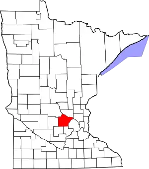 Map of Minnesota highlighting Wright County | |
| Townships | ||
| CDP | ||
| Unincorporated communities | ||
| Ghost town | ||
| Footnotes | ‡This populated place also has portions in an adjacent county or counties | |
| ||

| Authority control |
|
|---|